Paradise Row - now All Saints Road
& the Old Workhouse Yard
- The Six Acre Paddock
- Once again we have an area of Newmarket that has very
strong Royal connections. This page will concentrate on
the group of houses that were initially called Paradise
Row, but as the area had previously been one large paddock
owned by the King, details are also shown for adjacent
buildings that had important Royal associations.
Referring to details on the page about James I & Charles I's palace, the 1650 survey undertaken during the period of the English Civil War details a plot of land south of All Saints Church that had previously belonged to the crown - it was called the Six Acre Paddock.
On the 1821 enclosures map this plot of land is still entitled 'Crown Lands' and apart from the almshouses in the south-east corner (later the Workhouse Yard) and a small plot of land owned by F. Smallman there are no other buildings in this paddock.
The F. Smallman shown on the 1821 map was Francis Smallman; trainer to the Prince Regent (the Prince of Wales, later King George IV).
Francis Smallman can be still be seen living at this location on the 1841 census and by then he's listed as being in the 'Nunnery' stables in Dog Kennel Lane (Park Lane). It therefore appears that he must have been the original occupier who had the stables built for him. Details of this building are shown on the page for the Nunnery Stables.
- Paradise Row & Newtown
-
Victoria came to the throne in 1837 and from sometime around
then the area around here started getting very busy. Paradise Row first
appears on the 1841 census and there were 14 houses listed,
though their location is not at all obvious; as many
properties are listed amongst the houses of the Old
Workhouse Yard, though this fact does give an indication
as to its location.
Shortly afterwards in January 1848, following the opening of the railway between Newmarket and Great Chesterford, the area really began to grow. Newmarket's first railway station was at the southern end of this road, which obviously became a thoroughfare from the station to the centre of the High Street.
In 1851 a new branch line was built from here to Cambridge and from then onwards Newmarket became linked to the rest of Britain via the railway.
- Newmarket Local History Society - Newmarket Railways:-
 http://www.newmarketlhs.org.uk/lhs9.htm
-
The 1851 census is also very unhelpful; as apart from Church
Lane, no other addresses are given. What does become
evident from the trade directories around this time though
is that the whole of the area around here was called Newtown.
This name Newtown persisted until at least 1871, when on that census there are two houses called that, located somewhere around where Sweets Newsagents is now - Charles Adland, marine store dealer and Henry Segrott, shoemaker [a marine store dealer was a dealer in scrap materials].
The name also appears to have originally referred to the houses in Dog Kennel Lane (Park Lane), so it referred to this general area of Newmarket and wasn't specific to just All Saints Road.
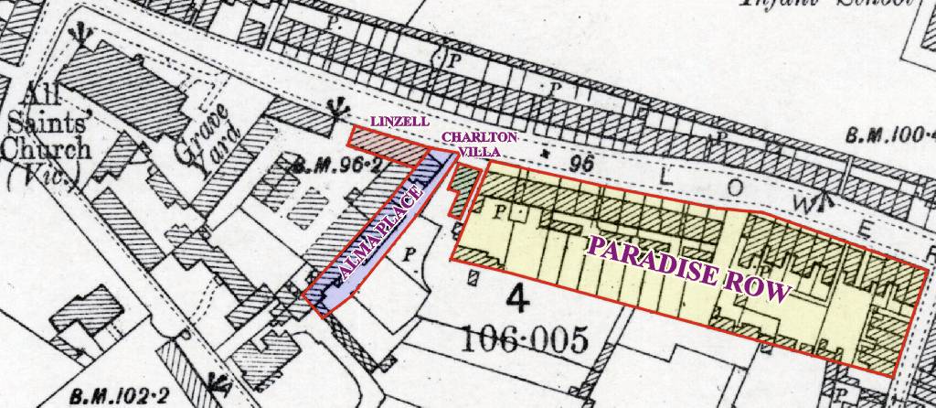
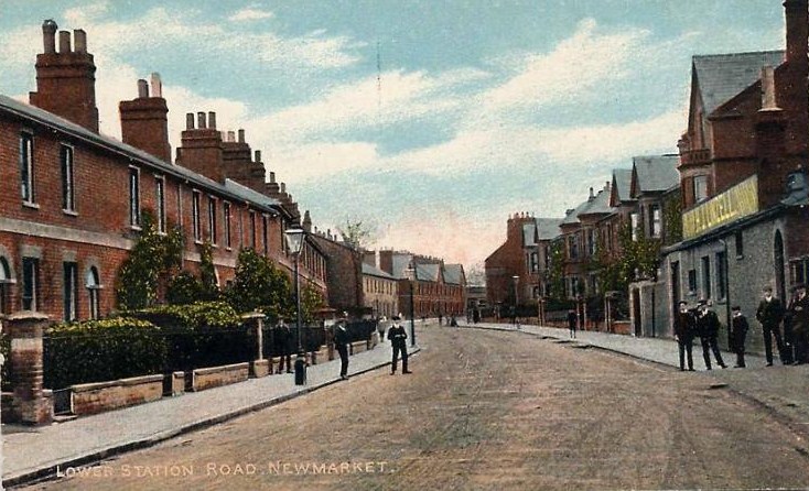
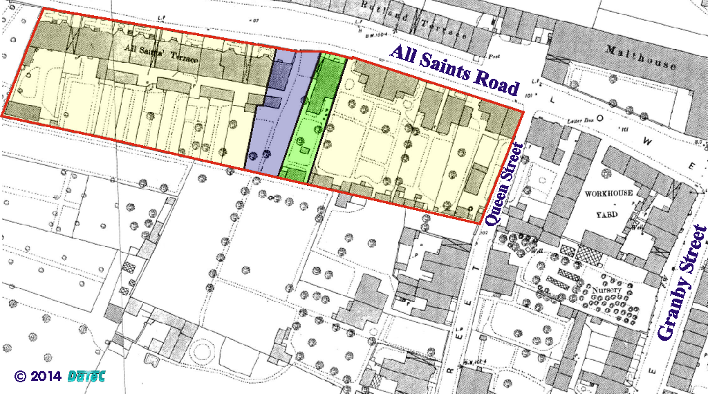
- By the 1861 census the name Paradise Row had re-appeared
again - the
houses were now clearly between Alma Place (the area at
the northern side of All Saints car park) and
the Workhouse Yard (the old Co-op shops), hence the overall area
of Paradise Row is outlined in RED
in the map above. At this time there were just 10 houses
in the row, though as can seen below most of these didn't
last and were replaced by later buildings.
-
By the 1871 census Turf Terrace and Rutland Terrace had appeared on the
other side of the road and in the middle of Paradise Row we now have Hermit Cottage,
which based upon later censuses it's known that this is the house
highlighted in GREEN
in the map
above.
-
Thomas Moody Hassall
- Paradise Row and Hermit Cottage had some very important
residents in 1871; Thomas Moody Hassall and his family
were in Hermit Cottage and his eldest son from his second
marriage; Tom lived next door. Thomas Moody Hassall was
the eldest brother of Harriett Moody - matriarch and
savior of the King's Head
Brewery in the Rookery.
Born in Reach in 1803, Thomas doesn't seem to have been involved in the brewery, as he became a hairdresser, which his son Tom also started out as, but by 1871 Tom had presumably joined the other part of the family's business as he's then listed as a brewer. Tom's time at the brewery didn't last long though, as by 1881 he'd moved further down the road into No.6 Jarrold's Buildings - the Workhouse Yard - and was listed as a hairdresser again.
This side of the family was consistent with the rest; as in later years they also dropped the Hassall from their surnames.
Thomas married his first wife Ester Hobbs in Newmarket on 28th July 1831, unfortunately she died in 1840 and he re-married to Marian Allen on 6th November 1845, this time at St Botolph without Bishopsgate in the City of London.
Thomas' daughter Phillis Moody was actually Shirley Crickmere's husband's grandmother - her location in the family tree can be seen below.
Following Thomas' death on 30th June 1879 Marian is still shown living in Hermit Cottage in the 1881 census. By this time the houses that had been at the northern end had been demolished and the census shows 10 new houses in the process of being built - this was All Saints Terrace as shown on the map above - No.16-32 All Saints Road.
In this census and in 1891 the name Paradise Row was now only being applied to the 6 houses at the southern end, up against Queen Street.
-
John Swindell, schoolmaster
- If you refer to the page for the Congregational
Church in the High Street you'll see that in 1850,
Newmarket was host to a very famous Baptist preacher - Charles
Haddon Spurgeon. While in Newmarket Charles spent his time
working at the
school of John Swindell, and in Slater's 1850 trade
directory this school is listed in Mill Hill in St Mary's
Square.
A year later, as listed in Gardner's 1851 trade directory, John Swindell had moved here to Paradise Row and is also shown at this location on the 1851 census with his staff and pupils. The building that housed the school is no longer there, but based upon details from later censuses it was located at the northern end of Paradise Row, in what is now All Saints Terrace and at the end closest to the present-day All Saints car park (somewhere around No.16 All Saints Road).
-
End of Paradise Row
- If you compare the 1901 map below with the 1885 map at
the top of the page you'll see
that the southern end of the area has changed drastically
- gone are the remaining 6 houses of Paradise Row, to be
replaced by a row of terraces that include the 5 houses of
Conway Cottages,
Virginia Cottage, Garden Cottage and Glen Terrace against
Queens Street.
The name Paradise Row has by then gone, to be replaced by Lower Station Road, applied to the whole street from Sun Lane all the way up to what was the main railway station at that time. Hermit Cottage is the only remaining old house along here, and it continued to be there for many years, although it's now been replaced by the new houses at No.36 All Saints Road.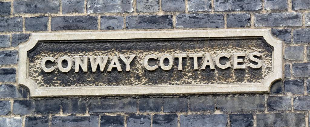
The map further down below is later still - 1926 - and although not much has changed with the houses, Lower Station Road has now become All Saints Road and the 10th house in All Saints Terrace has gone ... it was unoccupied in the 1911 census and by 1926 it had been replaced by All Saints Hall, the area of which is highlighted in BLUE in the 1885 map above. Shown in the Building Changes section below, the hall was built in 1911. All Saints Hall is no longer there, but where it stood is now No.34 All Saints Road.
The photo below was taken in All Saints Hall in 1967, showing the pupils of All Saints School performing a play about the church in the countries of the world [Note from webmaster, I'm in the photo].
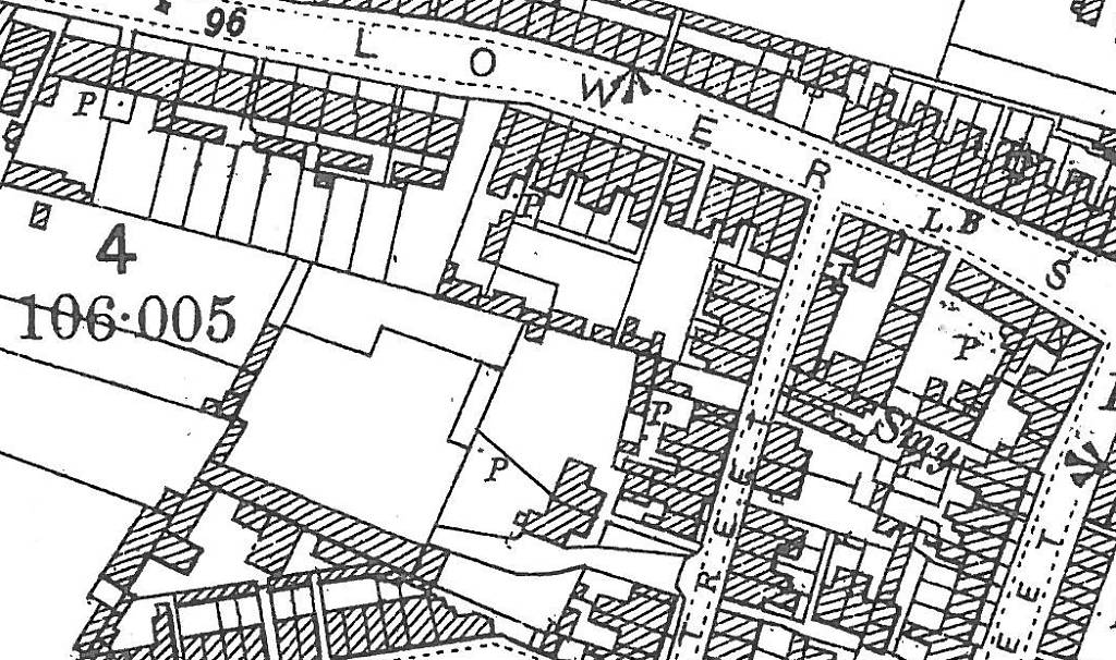
Paradise Row 1901 Map
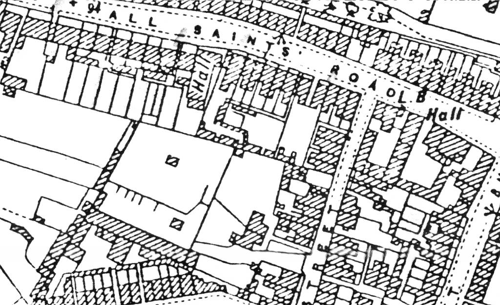
Paradise Row 1926 Map
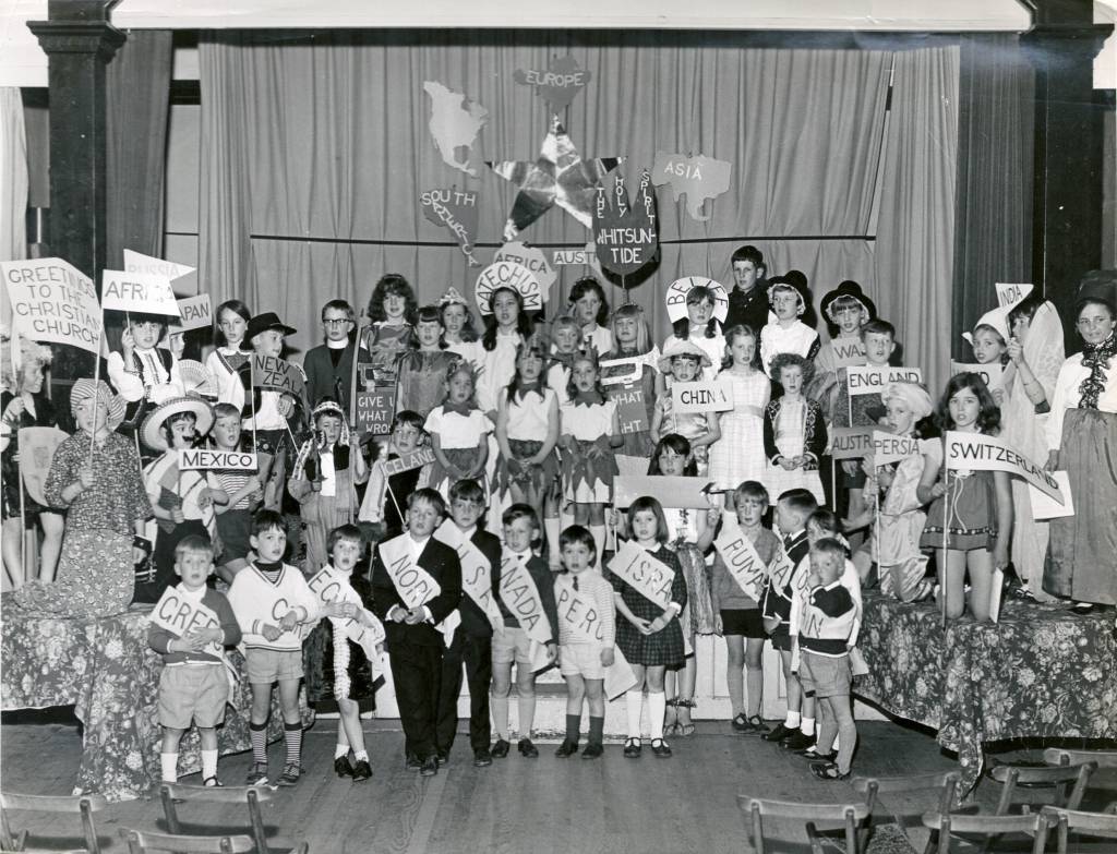
All Saints School performing a play for All Saints Church in All Saints Hall on Whit Sunday - 14th May 1967
The location of Hermit Cottage on the left
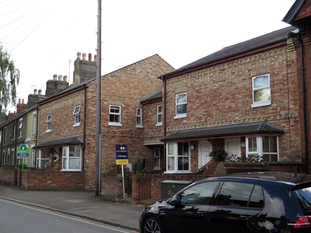
and All Saints Hall on the right - 2014
Lower Station Road Map 1885
[Reproduced with the permission of the National Library of Scotland]
-
Charlton Villa
-
Built sometime after 1881 and before it was given a name on the 1911 census there was another house between All Saints Terrace and Alma Place - it was called Charlton Villa. It'd been demolished by 1965; as by then the area was just rough ground and was being used as a makeshift car park. This location is now the entrance into the car park in All Saints Road.
-
Harry James Linzell & Leslie Raymond Edmondson, builders & contractors
-
Non-domestic buildings can be quite difficult to locate from historical records when there are no names listed for the premises on any of the censuses, but then when there's a photo of the location completely new buildings can suddenly become very obvious.
Situated on the northern side of Paradise Row, going towards All Saints Church, was the business of Harry James Linzell. From its position in the 1905 photo below the builders appears to have been located next to Alma Place and in one of the rear barns of what had been the Sunnyside Stables.
His workshop is clearly visible as the plain grey-fronted building on the far right-hand side of the photo - the name H.J. Linzell can just be made out in the name plaque on the roof. (Note that you can also see the top of Charlton Villa behind this name plaque.)
Although the map above only highlights the one building shown in the photo as being part of Linzell's business, it does look on this map that the whole square of buildings next to and behind it, that had at one time been the training ring and stables of Sunnyside, was now part of the builder's yard - if anyone can confirm that this was the case please E-MAIL.
In Kelly's Directory for 1901 the trade listing states - builder & contractor, plumber, gas & hot water fitter, bellhanger & general house decorator; offices & steam sawing & joinery works here in Lower Station Road; stone & monumental works in the High Street opposite the cemetery ... and also at Ipswich and Felixstowe.
The business was also listed there previously in Kelly's 1896 Directory and then before that time it was listed in 1892 in Park Lane & Market Street.
By 1916 the business had become known as Linzell & Edmondson and the address was by then All Saints Road. The High Street address for the stone & monumental works had gone and that was now listed in with his other trades here in All Saints Road.
Still here in All Saints Road, by 1925 the business was listed in Kelly's Directory as Edmondson, J & Son, builders & contractors, and then the 1936 Directory has it as L.R. Edmondson, builders.
Bury Free Press
Saturday 08 October 1932
FATAL ACCIDENT At Stetchworth Cross-Roads. Dullingham Man Killed.
Alfred Mingay, builder's labourer, of Cross Green, Dullingham, identified the deceased as his son, Reginald Alfred Mingay, aged 30 years. The deceased was a single man and resided with him. He was a lorry driver and had been in the employ of Messrs, Linzell & Edmondson, builders, of Newmarket.
- Following Harry Linzell's death in 1934 (see below) the
business was continued on by James Edmondson, who in his
latter days lived in Rose Bank, Woodditton Road. Then
following his death on 18th January 1937 his son Leslie
Raymond Edmondson took over the business. In addition to
being a builder Leslie was also the organist and
choirmaster at All Saints Church for many years - just a
few yards along from here.
-
Harry James Linzell
-
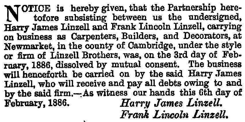
The son of James Linzell and Mary Ann (neé Hackwell), Harry James Linzell was born on 30th June 1855 in Tottenham. He's shown in Newmarket for the 1891 and 1901 censuses, when he was living in Home Cottage in Park Lane. The following article shows that he originally started his builders business in the town with his brother Frank Lincoln Linzell:-
Before this time he lived in Tottenham and then in 1911 is shown living in Stanley House, Orwell Road, Felixstowe. He died at his home; Baroda, Princes Road, Felixstowe on 25th February 1934.
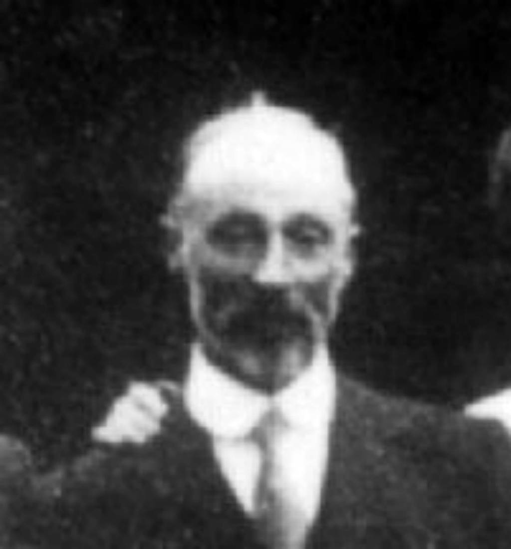
Harry James Linzell - 1912
Lower Station Road 1905
Many thanks to Roger Newman for this postcard
All Saints Road 2008
All Saints Road 2015
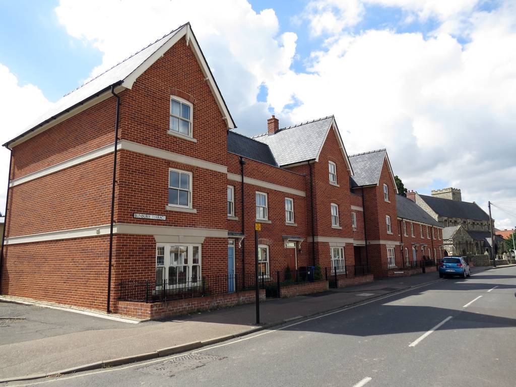
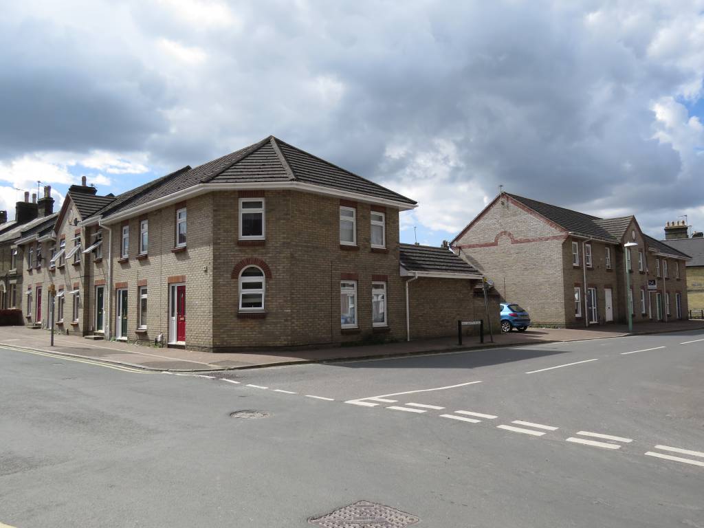
- All three of the above photos are taken from almost
exactly the same location. If you look at the sequence of
the first storey windows of the houses on the left hand
side (Turf Terrace) - 2,2,3,2 - this gives away the commonality
between these images. The nearest lamppost is also in the
same location for all three dates.
By this it can be seen that the location of Linzell & Edmondson builders later became the Co-op furniture store and then in 2008 that building had become Willie Thorne's Newmarket Snooker & Bowl. This has also now been demolished and new houses built on that site as shown in the 2015 photo.
-
Other important residents
- There've been a few other important residents that have
lived in and around the area of Paradise Row over the years:-
- Thomas Henry Sherborn
- the photographer - he lived in No.5 All Saints Terrace in
1911, which is now No.24 All Saints Road.
- Elizabeth Musk -
the founder of Musk's butchers - she was living in No.6 All Saints Terrace
in 1911 and 1926, which is now No.26 All Saints Road.
- William John
Harper - the great-grandfather of Grant Powter (owner
of Powter's
Butchers) - he lived in Alma Place in 1901.
- William James Moon -
the originator of Moon's Cycle shop, now Moon's
Toymaster - he lived in No.2 Alma Place in 1926.
- Peter Sayers
- during the 1960s the famous country & western artist
lived here with his mother in what had been Turf Terrace.
-
The Webmaster
- Sometime in the 1870s my great grandfather travelled the
70 miles from his birth place in Chorleywood, all the way
to Newmarket, most probably on the recently opened
railway. His father had been an Ostler; hence having been
brought up with horses he came here to work in the
stables.
His name doesn't appear in the list of residents in Paradise Row though, as in 1881 he was lodging in a house just around the corner in Granby Street. Newly married on 1st March 1884, by the 1891 census he'd moved in with his wife in the Workhouse Yard.
To give it its full name, it was the 'Old Workhouse Yard'. Clearly by this time, what had been the Almshouses on the 1821 enclosure map, had by now lost its original usage and had become a hive of activity; with a variety of tradesman living in and around the yard. From around 1916 the yard took on an even more industrious usage - as can be seen below had become the new premises of the Newmarket Co-operative Society.
My family's association with the area does still continue, as in the 1950s my mother started working at the Co-op offices across the corner in Vicarage Road. Then in 1965 we moved into All Saints Road, in a house in what had been Turf Terrace, directly opposite the location of Charlton Villa detailed above.
-
The Newmarket Co-operative Society & the Workhouse Yard
- If you compare the maps above of 1885,
1901 & 1926
you'll see that the area of the Workhouse Yard changes
very little over the years, and as can be seen in the
photo below when the 'Co-op' moved here sometime around
1910 they initially didn't
change very much and the buildings of the old yard can still
be seen
in the background.
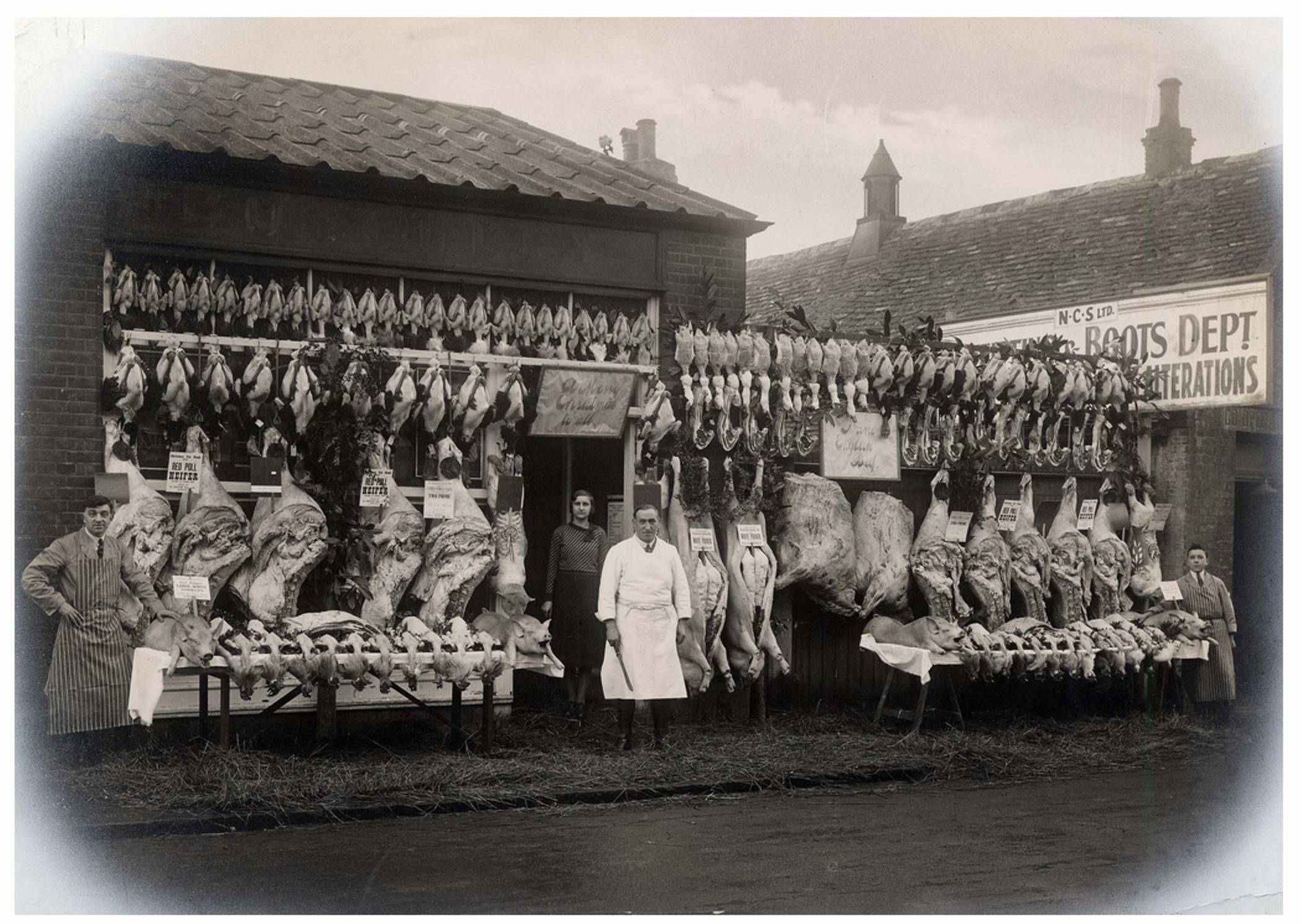
Newmarket Co-operative Society (NCS) Butchery c.1930
- the NCS boots department can be seen in the buildings of the old Workhouse Yard in the background
[click on the photo for a larger view]
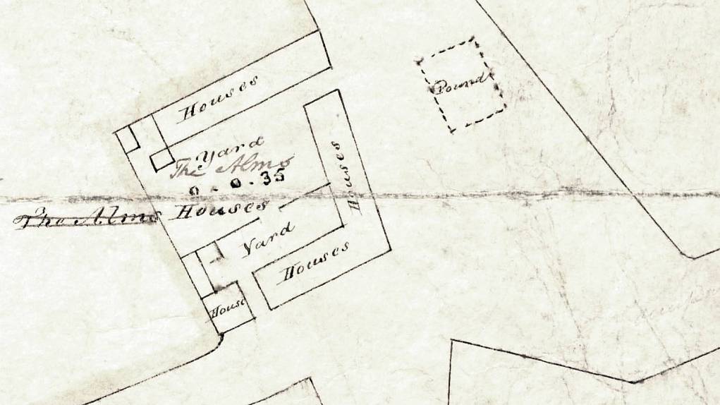
Detail from Stephen Piper's 1831 land sales map, showing the Alms Houses that later became know as the Workhouse Yard
- It's doesn't seem that the 'Workhouse Yard' was ever a
workhouse as such - as you can see that in the 1831 map
above the buildings were then known as 'The Alms Houses'.
Throughout all the censuses it was never listed as one
building with inmates, but always as individual
properties, with a maximum of nine households, reducing in
number to eight in 1861, and by 1911 there were only six
households with two lock-up shops and a blacksmith's forge.
[Note from webmaster - on my great grandparents marriage certificate of 1st march 1884 it shows that my great grandmother was living in the 'Workhouse Yard'. After their marriage they can be seen living together their on both the 1891 and 1901 censuses.]
- In the 1881 census the yard was called 'Jarrold's Buildings'
(in later censuses it reverted to being the Workhouse Yard).
At that time there were two Jarrold's living in the town -
George Jarrold, the grocer at No.18
High Street and Charles Jarrold who was the livery
stable manager at Hermit Stables and lived at Rupert House
- No.123 High Street. The only Jarrold to get a mention in
the Newmarket Urban District Council Records for building
work in the town was Charles; who extended Rupert House in
both 1894 and 1902 - so he seems to be the monied
individual who would most likely have been the then
landlord of the Workhouse Yard.
- As can be seen in the Building Changes section below,
over the years the NCS slowly re-built the yard and had
various shops in the different sections - which included a dairy, baby
clothes shop, butchers, furniture shop, ladieswear and
menswear.
Eric Tennant, who now has his butchers in the Guineas Shopping Centre, worked for a time at the Co-op butchers in All Saints Road.
The other part of their business was in the building on the opposite corner of this junction, in Vicarage Road, which over the years was the bakery, groceries, shoe shop, ladieswear, and with their 'divi' offices on the 1st floor above the shops. They also had a garage for storing their delivery vans further 'round the corner in All Saints Road.
They later opened a custom-built building further down All Saints Road - this became their new furniture shop and following its closure this became Willie Thorne's Newmarket Snooker & Bowl (even that's now gone and has been replaced by houses again).
Sometime before 1925 the NCS opened a shop on the other side of town in Exning Road (now the Clean Machine laundrette - No.129 Exning Road).
- Following closure of the shops in All Saints Road the
Co-op moved into No.116-No.118 High Street (now the
location of Store Twenty One).
 Paradise Row 1885 Map |
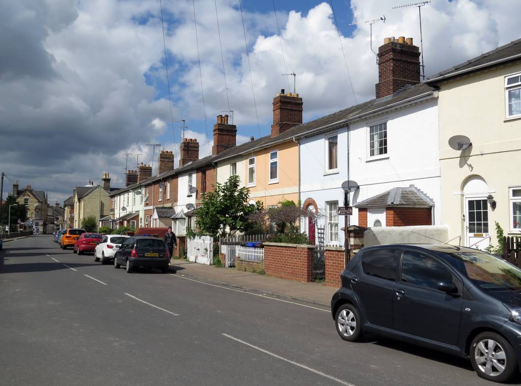 Turf Terrace 2014 |
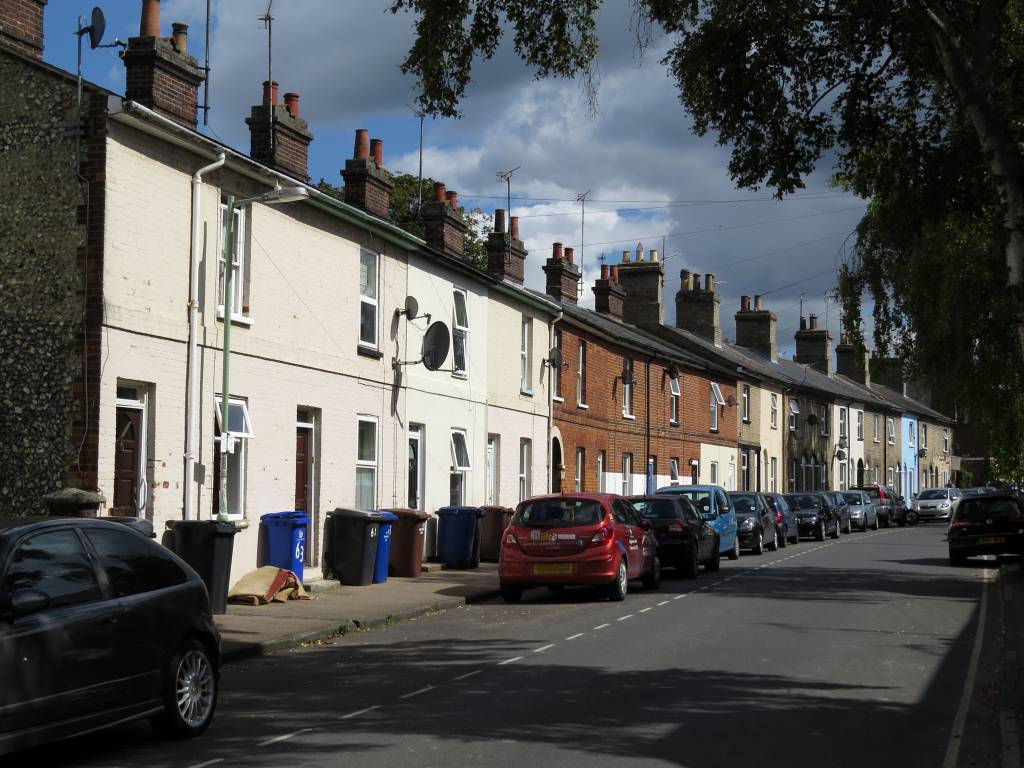 Rutland Terrace 2014 |
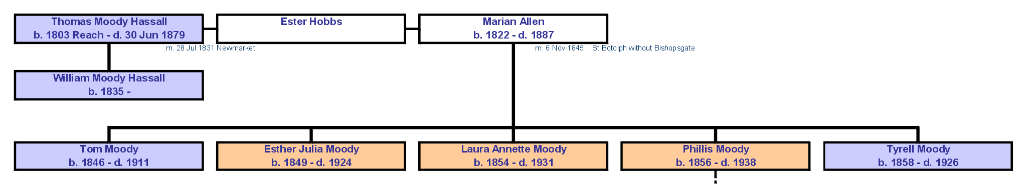 Thomas Moody Hassall's Family Tree [click on the picture for a larger view] |
1904 |
Newmarket Co-operative Society
Limited (Alfred Challis, manager & sec.), |
1916 |
Newmarket Co-operative Society
Ltd. (Alfred Challis, mgr. & sec.), |
|
1925 |
Newmarket Co-operative Society Ltd. (Alfred Challis, manager
& sec.), |
|
1926 |
Newmarket Co-operative Society Ltd. furnishing department |
|
1936 |
Newmarket Co-op, All Saints Road |
 The former location of the Co-op furniture shop and Alma Place - 2014 |
 Co-op Corner All Saints Road - 2014 - the former location of the Workhouse Yard |
-
Building Changes
-
Suffolk Record Office, Bury St Edmunds Branch
Newmarket Urban District Council Records
Reference EF 506
- Parish memorial hall adjoining All Saints' Terrace, for Mrs Dalton
(A.S. Manning) EF 506/6/1/13/397 Apr 1911
- Bakery, Vicarage Rd, for Newmarket Co-operative Society EF 506/6/1/7/65 (1901)
- Addition to existing premises, Lower Station Rd, for Newmarket Co-operative Soc (Heaton & Gibb) EF 506/6/1/9/193 Feb 1904
- Stabling and corn loft, Vicarage Rd and All Saints' Rd, for the Co-operative Society EF 506/6/1/12/339 Jul 1908
- Warehouse, Vicarage Rd, for the Co-operative Society Ltd EF 506/6/1/12/342 Aug 1908
- Extensions, Co-operative Stores, All Saints' Rd, for the Newmarket Co-operative Society Ltd (A. Challis) EF 506/6/1/13/381 Jul 1910
- Warehouse and stores, All Saints' Rd, for Newmarket Co-operative Society EF 506/6/1/14/423 Jan 1912
- Shop front, warehouse, for the Newmarket Co-operative Society EF 506/6/1/14/433 Sep 1912
- Store and shop, All Saints' Rd, for the Newmarket Co-operative Society EF 506/6/1/17/553 Apr 1920
- Shops and alterations at Workhouse Yard, All Saints' Rd, for the Newmarket Co-operative Society Ltd EF 506/6/1/17/567 Aug 1920
- Room over garage and covering-in of yard, stores in All Saints' Rd, for the Newmarket Co-operative Society (Rodrigo Palethorpe) EF 506/6/1/19/655 Oct 1923
- Gable end to covered yard, All Saints' Rd, for the Newmarket Co-op
Soc Ltd (Rodrigo Palethorpe) EF 506/6/1/19/680 Dec 1924
- Return to top of page